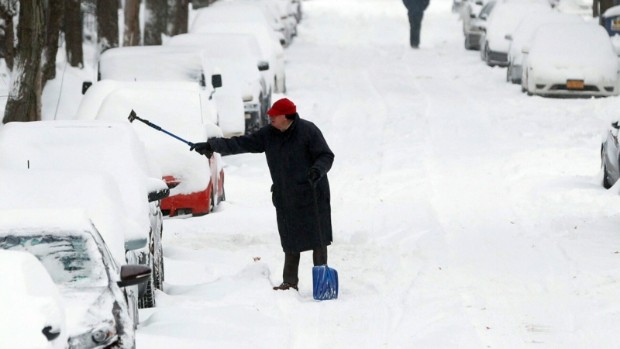
Southern-Ontario and the greater Toronto area are about to get hit with another winter storm. The weather will hit in several waves over the next few days. The latest warnings from Environment Canada say freezing rain and heavy snow squalls could make driving treacherous. Extreme cold temperatures will follow and could make the clean-up difficult. Here are the latest warnings in effect:
(Listen to Z103.5 Toronto tomorrow morning for the latest traffic, bus cancellations, school closures, airport delays, and more.)
Freezing rain warning for: City of Toronto, Hamilton, Halton-Peel, York-Durham, Waterloo-Wellington, Niagara, Peterborough, Ottawa, and more.
6:29 AM EST Sunday 05 January 2014
Freezing rain warning
City of Toronto:
A couple hours of freezing rain possible north of lakes Erie and Ontario this evening. Significant freezing rain over Eastern Ontario overnight and early Monday morning.
An intensifying low over Arkansas will be heading towards Southern Ontario today. A band of light snow currently lying across the region will be replaced by heavy snow this afternoon over Extreme Southwestern Ontario and east of Lake Huron. The heavy snow is forecast to reach areas east of Georgian Bay early this evening.
Northwest of a line from roughly Leamington to Stratford to Barrie to Pembroke, total snowfall amounts of 15 to 20 cm are expected before the snow tapers off overnight into early Monday morning. 20 to 25 cm may be possible locally under the heaviest snow. Blowing and drifting snow will also be likely tonight and Monday due to blistery winds associated with the storm.
Southeast of this line amounts will be limited as the snow is forecast to change to rain as temperatures rise above the freezing mark. For areas north of lakes Erie and Ontario a period of ice pellets and freezing rain is expected this evening during the snow to rain transition. Over Eastern Ontario, a more prolonged event is possible overnight with several hours of freezing rain forecast before temperatures rise above zero Monday morning.
In the wake of the storm, bitterly cold west to northwest winds will result in the development of intense snow squalls southeast of Lake Huron and Georgian Bay. Snowfall amounts of 10 to 15 cm are forecast over a large area Monday as the winds carry the squalls far inland and are forecast to shift during the day. Very low visibilities will be likely with near whiteout conditions possible under the most intense snow bands.
These cold, brisk winds will also likely produce widespread dangerous wind chills beginning Monday night as some of the coldest air in years blasts across the region.
Travel conditions are expected to deteriorate and become hazardous due to accumulating snow and reduced visibilities in falling snow and blowing snow. Furthermore, where freezing rain falls, untreated surfaces will quickly become icy and slippery.
There is still some uncertainty as to the exact track of the storm centre and where the freezing rain and heaviest snow will fall. Environment Canada will continue to monitor this evolving situation and update warnings accordingly.
Snow Fall and Snow Squall Warnings in effect for: Halton-Peel, Waterloo-Wellington, Perry Sound, Muskoka, Dufferin, Innisfil, Barrie, Orillia, Midland, Peterborough, Haliburton, Grey-Bruce, and more.
6:29 AM EST Sunday 05 January 2014
Snowfall warning for
Orangeville – Grand Valley – Southern Dufferin County continued
15 to 20 cm snowfall today and tonight.
An intensifying low over Arkansas will be heading towards Southern Ontario today. A band of light snow currently lying across the region will be replaced by heavy snow this afternoon over Extreme Southwestern Ontario and east of Lake Huron. The heavy snow is forecast to reach areas east of Georgian Bay early this evening.
Northwest of a line from roughly Leamington to Stratford to Barrie to Pembroke, total snowfall amounts of 15 to 20 cm are expected before the snow tapers off overnight into early Monday morning. 20 to 25 cm may be possible locally under the heaviest snow. Blowing and drifting snow will also be likely tonight and Monday due to blistery winds associated with the storm.
Southeast of this line amounts will be limited as the snow is forecast to change to rain as temperatures rise above the freezing mark. For areas north of lakes Erie and Ontario a period of ice pellets and freezing rain is expected this evening during the snow to rain transition. Over Eastern Ontario, a more prolonged event is possible overnight with several hours of freezing rain forecast before temperatures rise above zero Monday morning.
In the wake of the storm, bitterly cold west to northwest winds will result in the development of intense snow squalls southeast of Lake Huron and Georgian Bay. Snowfall amounts of 10 to 15 cm are forecast over a large area Monday as the winds carry the squalls far inland and are forecast to shift during the day. Very low visibilities will be likely with near whiteout conditions possible under the most intense snow bands.
These cold, brisk winds will also likely produce widespread dangerous wind chills beginning Monday night as some of the coldest air in years blasts across the region.
Travel conditions are expected to deteriorate and become hazardous due to accumulating snow and reduced visibilities in falling snow and blowing snow. Furthermore, where freezing rain falls, untreated surfaces will quickly become icy and slippery.
There is still some uncertainty as to the exact track of the storm centre and where the freezing rain and heaviest snow will fall. Environment Canada will continue to monitor this evolving situation and update warnings accordingly.


