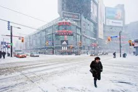
A special weather statement is in effect for the Greater Toronto Hamilton Area warning that tomorrow’s commute could be a snowy mess. 5-10cm of snow is on the way, starting tonight. The bulk of it will fall while you sleep. Up to 15cm of snow is expected for the stretch between Hamilton and Niagara. Here is the special weather statement from Environment Canada:
Updated: 4:41 AM EST Tuesday 04 February 2014
Some snow beginning tonight and tapering off Wednesday.
A developing low pressure centre is expected to emerge from the Southern United States today and head towards Pennsylvania by Wednesday morning. Snow will spread into Southwestern Ontario this evening and the Golden Horseshoe around midnight. It is expected to reach communities north of Lake Ontario overnight and Eastern Ontario very early Wednesday morning.
Most regions from Windsor to Toronto to Kingston and Brockville may receive a few centimetres of snow by Wednesday morning rush hour. Commuters should allow some extra time due to accumulating snow and reduced visibility in falling snow.
Total amounts of 5 to 10 cm are possible by the time the snow tapers off on Wednesday. However, the Niagara and Hamilton regions will likely receive some enhanced amounts due to somewhat heavier snow off Lake Ontario. 10 to possibly 15 cm may fall in this area. A snowfall warning (issued when 15 cm falls within 12 hours) is not expected but conditions will be monitored closely.
Please monitor the latest forecasts and warnings from Environment Canada at www.weatheroffice.gc.ca.


