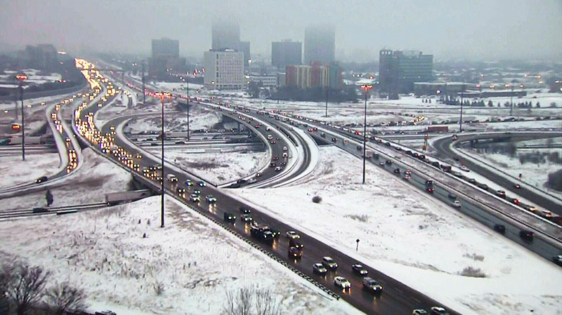
Environment Canada has issued a special weather statement for parts of Ontario including the Greater Toronto Area, warning of freezing drizzle throughout the morning. Roads may become slippery. Delays at the airports are possible. Here is the statement:
WOCN11 CWTO 090935
Special weather statement updated by Environment Canada at 4:35 AM
EST Monday 9 December 2013.
---------------------------------------------------------------------
Special weather statement for:
=new= Grey - Bruce
=new= Belleville - Quinte - Northumberland
=new= Peterborough - Kawartha Lakes
=new= Parry Sound - Muskoka
=new= Burk's Falls - Bayfield Inlet
      City of Toronto
      Windsor - Essex - Chatham-Kent
      Sarnia - Lambton
      Elgin
      London - Middlesex
      Simcoe - Delhi - Norfolk
      Dunnville - Caledonia - Haldimand
      Oxford - Brant
      Niagara
      City of Hamilton
      Halton - Peel
      York - Durham
      Huron - Perth
      Waterloo - Wellington
      Dufferin - Innisfil.

      Patchy freezing drizzle possible this morning.  Lake effect
      Snow developing near Lake Huron and Georgian Bay later today.

---------------------------------------------------------------------
==discussion==
A low pressure system crossing through the Great Lakes will bring
some light snow across the above regions this morning.
Snowfall amounts will be quite light, with near two centimetres
expected.  More importantly, there is also a risk of patchy freezing drizzle which may have an impact on the morning commute.

The risk of freezing drizzle will end later this morning.

Motorists and pedestrians are urged to exercise caution as untreated surfaces may become quite slippery.

For areas to the east of Lake Huron and Georgian Bay, lake effect
flurries are expected to develop later today and persist into tonight as colder air moves into the region.  These flurries are expected to intensify on Tuesday with snow squalls likely.  Up to 5 centimetres are expected later today into tonight with an additional 10 to 15 centimetres possible on Tuesday.  Snow squalls may continue into Wednesday and Thursday.

There is still considerable uncertainty regarding which locations
will see the most significant amounts at this point.
Environment Canada will continue to monitor this situation and may
issue snow squall watches later today.

End


