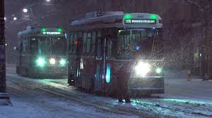
A freezing rain warning has been issued for Toronto, Hamilton, Dufferin-Innisfil, Halton-Peel, York-Durham, and Waterloo-Wellington. Freezing rain could start tonight and create major delays tomorrow. Scott & Kat will have the latest traffic reports, delays, cancelations, and more. Wake up with Z103.5. Here is the freezing rain warning:
City of Toronto
4:57 PM EST Thursday 19 December 2013
Special weather statement for
City of Toronto continued
A wintery mix over most of Southern Ontario tonight through Friday night. A break Saturday. Potential ice storm for much of Southern Ontario late Saturday into Sunday with snow possible over northern sections and rain or ice near Lake Erie.
A disturbance from Texas will cause an area of mixed precipitation to spread into Southwestern Ontario this evening and through the remainder of Southern Ontario by Friday morning.
Over Southwestern Ontario precipitation will be mainly in the form of rain. General rainfall amounts near 10 mm are expected by Friday night with up to 25 mm in a few locales.
In a band from Southern Lake Huron through the Greater Toronto area and eastward to Kingston, periods of freezing rain are expected Friday. Please refer to the freezing rain warning which has been posted for those locales.
Further north from Northern Lake Huron through Barrie and east of Georgian Bay to the Ottawa Valley, precipitation will be mainly in the form of snow. Total amounts are forecast to average near 10 cm over these regions Friday. The snow could change to periods of freezing rain in some places late Friday.
After a break Saturday another more potent storm from the United States will approach Southern Ontario late Saturday. An ice storm will be possible across a large swath of Southern Ontario, with significant rainfall likely near Lake Erie and significant snowfall and ice pellets from Northern Lake Huron to the Ottawa Valley.
There is still uncertainty surrounding the exact position of the storm track. Any change in the storm track’s position will affect precipitation amounts and type. However, it is very likely that holiday travel will be significantly impacted. We recommend watching future forecasts and taking the necessary precautions. Environment Canada will continue to monitor this developing situation and will issue warnings as necessary.


